New features, upgrades announced for the NJ Highlands Trail
WEST MILFORD. Hikers can explore the local wilderness with the help of free maps and new signage.

The New York-New Jersey Trail Conference recently completed a Highlands Council-funded project to enhance signage and mapping along the New Jersey portion of the Highlands Trail, Carole Ann Dicton, NJ Highlands Council manager of communications reported.
In 2019 the Highlands Council awarded a $29,000 grant to the Trail Conference to create one consistent Highlands Trail map from end to end and to enhance signage along the route to make it easier for visitors to find and use the trail. Previously, to navigate the trail, users historically had to reference several different maps and written descriptions.
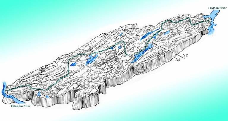
As part of the project, 500 blazes (trail markers) and 88 signs were created and are currently being installed along 130 miles of the New Jersey portion of the Highlands Trail, which runs from the Riegelsville Bridge in Pohatcong to the New York border in West Milford.
“One of the best ways to experience all the Highlands has to offer is to get out on a trail,” Carl Richko, former mayor of West Milford who now chairs the Highlands Council, said. “The Highlands Act, first and foremost, directs us to protect the region because of the critical water resources here. But it also clearly acknowledges the importance of protecting the region for our enjoyment and ensuring its long-term viability. The Highlands Trail presents a perfect opportunity to promote tourism that will contribute to economic stability in the Highlands.”
The complete long-distance Highlands Trail runs 180 miles from the Delaware River to the Hudson River, with additional miles maintained by the Appalachian Mountain Club in Pennsylvania. There are also plans to extend north into Connecticut. The selected route traverses the Highlands via established trails through existing parks and preserved open spaces with some road walking to provide connections. The trail route is designed to highlight the abundant natural and built resources in the Highlands and emphasize its critical importance to the region.
“The New Jersey portion of the Highlands Trail travels right through the heart of the region, showcasing the diversity and beauty of our landscapes and communities,” explained Lisa Plevin, Highlands Council executive director. “The trail represents an untapped opportunity to connect trail users with local businesses, such as restaurants and stores, and expand tourism in the region. This signage and mapping project is the first critical step in that process.”
Dicton said the new signage includes trail and spur blazes that augment existing painted turquoise blazes and help clarify the route, trailhead signs in parking areas to help direct users to trailheads along the route, long-distance signs showing distances to prominent features along the trail, and directional signs placed in areas where roadside pull-offs are used to access the trail.
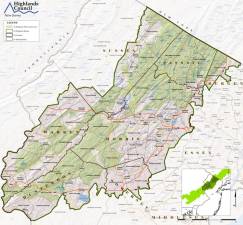
Dicton said a free of charge overview map will also be available at kiosks at 10 state park offices and several other distribution points along the route. Overview maps are also available at the Highlands Council office in Chester. The free of charge Avenza Maps app version of the end-to-end map is available now, and the installation of signage is expected to be completed before the end of summer.
Additional information is available at TheHighlandsTrail.org, including details about accessing the Avenza Maps app. Those who already have the free app can download the map now by searching “Highland Trail.” Dicton advised people to be sure to select the free “Highlands Trail in New Jersey” map from the New Jersey Trail Conference.
She said anyone familiar with the Trail Conference’s popular trail maps will recognize the quality and detail of the map available in Avenza, with the additional benefit of being able to pinpoint their location on a map, without cell or WiFi connectivity, using built-in GPS features.
Users can also orient themselves with a built-in-compass; add place markers to mark a specific location for future reference using custom symbols, names, and/or geo-tagged photos; and track or navigate live using GPS.


