‘Greenway’ will link trails with businesses and recreation areas
West Milford. Creating of a Greenway of hiking trails and waterways could connect budinesses with recreational and community facilities with the help of a $40,000 from the Highlands Council.

Creation of a “Greenway” of hiking trails and waterways that connect businesses with recreational and community facilities is underway in West Milford with help of a $40,000 grant from The Highlands Council.
The West Milford Economic Development Committee (EDC) and West Milford Environmental Commission (EC) members are working jointly to make a new living concept available to residents of West Milford and its visitors. Greenways are outdoor spaces connecting people and places. Each Greenway is unique, reflecting the character of each area where it is established.
The Highlands Council recognized the Greenway Feasibility Study aimed to address recommendations in the township’s recently completed Sustainable Economic Development Plan and Open Space/Recreation Plan, both of which are consistent and promote goals of the Highlands Regional Master Plan. The funding was relocated from an earlier grant of the same amount for Jessica Caldwell of Newton to complete the Greenway facility study, Highlands Council Executive Director Lisa J. Plevin told Mayor Michele Dale in a letter. With the approval, the township was authorized to have Caldwell begin work. The funding is contingent on the township’s ability to complete all the work described in the scope of work within the proposed schedule.
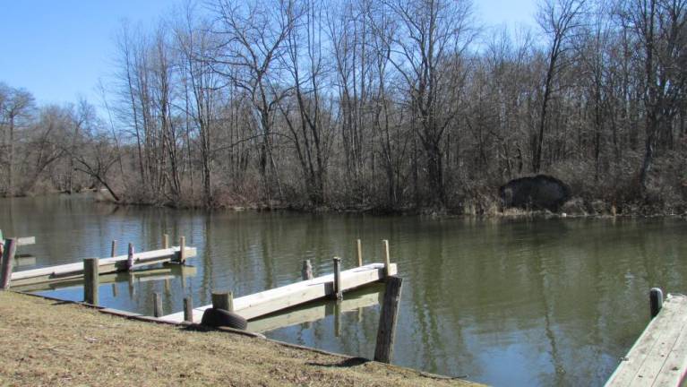
A sub-committee of the EC, requested by Mayor Michele Dale to study and evaluate the possibility of establishing a “Greenway” or “Pathway” along Belcher’s Creek from Pinecliff Lake to Camp Hope, and then onto Brown’s Point at Greenwood Lake, has finished a first phase plan of the trail and is starting work on the second lap. The path will not only be for pedestrian use but will facilitate possible kayak and/or canoe use of Belcher’s Creek.
Stage One of the Greenway Overall Concept, when completed, will connect Pinecliff Lake to the Wallisch Homestead and then go to Camp Hope, traveling by way of Belcher’s Creek. This connection will begin at the end of New Jersey Avenue (off Union Valley Road at the foot of the Pinecliff Lake Dam) and go on to the Wallisch property and continue to Camp Hope. There are some private properties in this section, therefore some easements need to be obtained by the administration.
EC Chair Steve Sangle, who also chairs the Greenway sub-committee, said work on determining the Stage Two path of the trail connecting Camp Hope to Brown’s Point at Greenwood Lake is getting underway. He said there appear to be choices of various possible routes, all along Belcher’s Creek, to consider.
“We will do our best to determine the most environmentally friendly route with the least number of costly options and environmental disturbances, Sangle said. “For both phases we will attempt to connect the Greenway with commercial and recreation areas such as ballfields and trails. The commercial areas and neighborhoods – for example Lincoln Village, ShopRite, Bearfort Village, Belcher’s Run, Tractor Supply and Greenbrook Estates. Possible places for parking and economic revitalization for those areas are also possible considerations.”
This is only the beginning of the township’s Greenway network. Sangle and his committee will look into more connections for trails and other means for residents to go from areas of need such as shopping centers and trail heads.
Tom Castronova, secretary for the EDC, reported details of mapping West Milford’s Outdoor Recreation Opportunities when he addressed the local governing board at a recent meeting. He said the target audience for a proposed map includes residents and visitors, hikers, backpackers, paddlers, cyclists, prospective users, land managers, recreation/conservation planners, government officials, outfitters, local businesses, funders and others.
Objective for the EDC through the proposed map is to inspire interest in West Milford, New Jersey’s outdoor recreation and open space opportunities, orient people to and within these locales, connect users to relevant local businesses, stewardship groups and governments, and encourage sustainable practices while visiting public lands and waters,
Castronova said the map will accurately display all legitimate outdoor recreation assets within map extent, including public lands (federal lands, state parks, county parks, local parks), rivers/lakes, trailheads, boat launches, trails, points if interest, overlooks, campgrounds, and cultural/interpretive sites. He reported work would be with regional land managers, outdoor recreational organizations, non-profits, and governments to obtain and use up-to-date data to produce the most accurate and well-reviewed map possible.
The map proposed would be two sided with in trail guide format, displaying details about public lands, roads, trails, points of interest, municipal and cultural information, and it would tell of infrastructure, topography, land cover, and hydrography on one side of the map. Descriptive text, informative tables, graphics, details and photography would be on the other side.
Giving a timeline for the map, Castronova said initial data collection and connections will begin in January 2023 with work on the project to be started in March 2023 with completion of the map by Jan. 1, 2024. Total cost was estimated at $5,000. Work would be done by a professional map company.

